


3D Landscape Visualisation attempts to represent actual places and on-the-ground conditions in three dimensional (3D) perspective views, with varying degrees of realism.
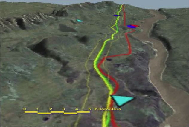
Using 3DEM software, Petr Cizek animated a fly-through of the Mackenzie River valley in the Northwest Territories showing the proposed Mackenzie Gas Project pipeline for the Canadian Arctic Resources Committee, which was distributed to communities within the pipeline corridor on DVD.
Using Google Earth Pro software, Petr Cizek also animated the uranium staking rush at the abandoned Port Radium mine and surrounding Great Bear Lake for the documentary film Somba Ke: The Money Place, which was broadcast on Global TV, the Sundance Channel, and NHK in Japan.
In their interventions with the government of British Columbia, the Friends of Davie Bay on Texada Island contracted CIZEK ENVIRONMENTAL SERVICES to create an interactive Google Earth project showing a proposed barge loading dock at an ecologically sensitive site. This project was then featured in an article in a special issue of Future Internet Journal on "Internet and Landscapes", which discussed how virtual globes are being used by citizens' groups across British Columbia.
 Existing and proposed tar sands open pit mines, AlbertaFor his PhD dissertation, Dr. Cizek integrated Google Earth Pro with Visual Nature Studio software to show the cumulative development of Alberta tar sands open pit mines and associated pipelines. To evaluate user response to interacting with these 3D landscape visualisations, focus group workshops were held in university computer laboratories in Vancouver and Edmonton.